 For a brief period last week, both Bud and Carlotta were dual hurricanes in the Pacific, before they reached cooler waters and degrading back down into tropical storms.
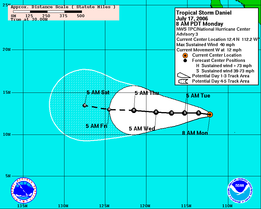
Yesterday, a tropical disturbance formed far to the south of Baja California and quickly increased in convective activity and organization. The National Hurricane Center designated it as a tropical depression that night. The depression continued to organize and was designated as Tropical Storm Daniel today.
As of 2 p.m., T.S. Daniel had maximum sustained winds of 45 mph, with higher gusts. The storm was moving toward the west at about 12 mph. The storm is forecast to continue westward and intensify into a hurricane within the next 48 hours. National Hurricane Center forecasters note that there is the possibility of rapid intensification similar to Bud last week.


No comments:
Post a Comment